(Slideshow of photos at the bottom)
Today was much less hassling trying to get around. Buses were back up to their full schedules as were the ferries between islands. I got up early enough to hop a bus back to Stromness from Kirkwall and then had 10 minutes to get onto the little passenger ferry, taking me out to the island of Hoy. It was another sunny day, though still chilly, that provided me with great views of Stromness as we pulled out of the harbor and into the tidally forceful Scapa Flow. There was a little story I read, I think at the Flattie Bar yesterday while in Stromness, that described life on the water: people living there were sailors and fishermen by trade so they were very comfortable being on the water, but the kids who had their own little boats (the Flatties of the pub's name) were warned to not sail past black buoys placed out near the mouth of the harbor because from there on out, the tides and currents were much to strong and would carry them away, out to sea.
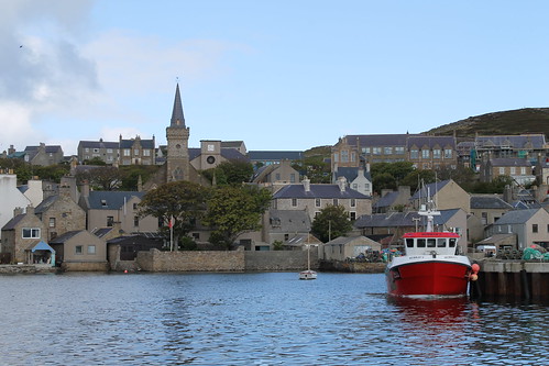 |
| Leaving Stromness Harbor |
Today, though, the ferry easily navigates the tides and we pulled out into the channel between mainland Orkney and Hoy. Again, here was an entrance to the protected harbor where the WWI and WWII British Navy Fleets were stationed, so you can still see the old watch-houses and bunkers along the islands that were used to protect that channel entrance from any German threat. They are abandoned now, but still stand in silent guard.
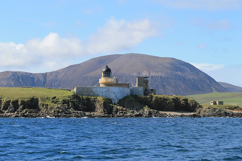 |
| WWI/WWI-era look-outs on the shore of the isle of Graemsay with mountainous Hoy in the background |
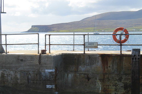 |
| Docking at the isle of Hoy |
To get out to the Old Man of Hoy, you have a few options. You can prearrange a cab to pick you up at the ferry dock, you can sign up for a guided tour, you can bike out there, or you can hike the 6.5 miles from the docks, through glacially sculpted valleys, and then up to the site. I bought some new hiking boots when I was in Michigan for my sister's wedding and since I didn't want to pay for a bike rental or a cab, I decided to hike. The first mile and a half are all up a one-lane road leading away from the ferry dock, through sheep pastures, and through some moors. The road eventually turns, but hikers continue the next two and a half miles through the glacial valleys, which are protected as part of the Scottish National Bird Sanctuary. Because of this, though, I was warned by a local Orcadian that you kind of have to keep your eyes open for any divebombing Great Skua birds (called, Bonxies by the locals). They kind of soar around above you and if you get too close to their nests, they will squawk and dive toward you. I won't lie, I had a few stones in my hands just in case, and even shouted at a few that I thought were flying too close to me! There was a little reservoir up in the valley that most of the bonxies stuck to, and once I was past that, they were no longer a problem!
 |
| The lonely road out to the hiking path to Rackwick on the isle of Hoy |
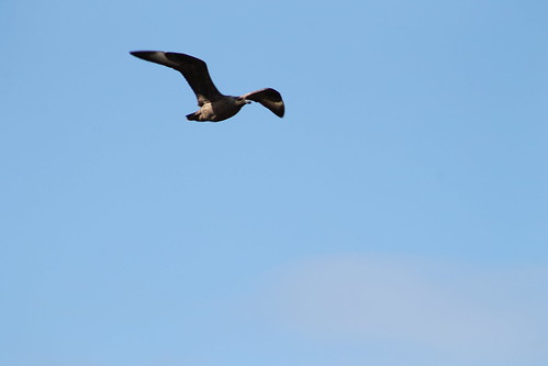 |
| Watch out for the dive-bombing bonxies! |
Further down the valley, tucked away in little stream valleys, are some of the last remaining wild Orcadian forest, that used to cover much of the islands. Over 5,000 years of constant settlement and agriculture, it's no wonder there is little left of these forests. But then the trail reconnects with the road which ends not much further in the little town (if you can call it that) of Rackwick.
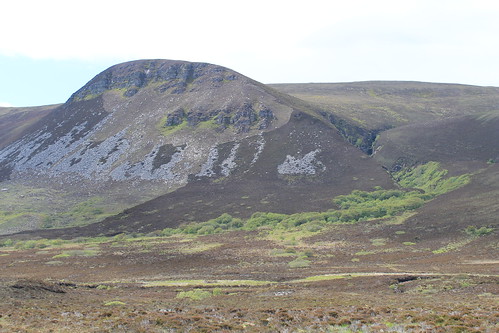 |
| Some of the original, most northerly native woodland in the British Isles |
Rackwick is literally the end of the road, but it is a beautiful end of the road with a wide, sweeping beach with turquoise water, nestled between huge, enormous, sandstone cliffs. And I'm not talking 100-foot-high Sydney Coastal Walk cliffs, or even 200-foot-high Pictured Rocks cliffs, or even 400-foot-high Cliffs of Moher. These cliffs jut up 500-feet from the ocean far below (and they aren't even the tallest, which rise up over 1,000 feet!). So Rackwick is a beautiful end of the road, but not the end of the journey out to the Old Man of Hoy, which still requires a two and a quarter mile hike along cliffs and over coastal plateaus. But once you are there, it is such a treat! Standing 450-feet up from the ocean, far below, is this behemoth of stacked beds of sandstone, flanked to the south by similarly-high cliffs, and to the north by the massive 1,000 foot cliffs! Now, believe me when I say that the Cliffs of Moher are beautiful and stunning, but the fact that they are so accessible and overrun by tourists makes them a bit less wonderous, compared to these massive cliffs that only those willing enough to hike a few miles will ever get to.
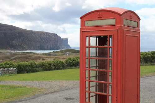 |
| Old British Telephone booth at the Rackwick Hostel, looking down at the town and the massive sea cliffs |
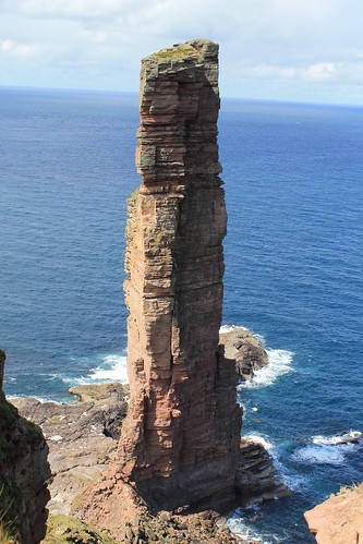 |
| The Old Man of Hoy: 450 feet tall and the tallest sea-stack in the UK |
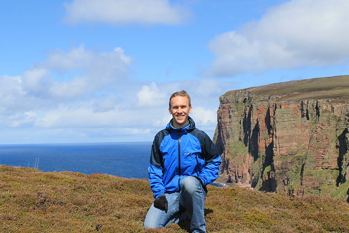 |
| Me with the sea cliffs north of the Old Man of Hoy |
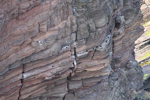 |
| Puffins! This was the best shot I could get, even with my 18x zoom lens... But some birdwatchers there told me of better places closer to Glasgow I can go to get better photos |
I stayed out at the cliffs for a little while, enjoying my packed lunch of cheese, jerky, an apple, biscuits, and crisps, watching the sea birds (mostly seagulls, but I did see some puffins, too! - just very, very far below me...) and chatting with a few of the other visitors who were from all over the place: Germany, southern England, California... They all had a few good stories and we each helped the others take photos. It did start to sprinkle, just a thin band of rain, but it was also time to head back to the ferry dock. I wanted to take a more rigorous route up above the massive cliffs to the north, but being alone, without a detailed map, and on a time constraint, I decided it would be better to go back the way I came and leave the high-cliff route for another time. Back toward the ferry dock, a lot of tourists were having an afternoon tea at a little cafe. It was nice, but definitely priced more for the retired clientele who have a little bit more pocket change than your average student day-hiker, but I bought an Irn-Bru and gave my feet a rest in the yard, watching a chicken hobble around.
I had to catch the first afternoon ferry back to Stromness in order to get the right bus out to Maeshowe, which I wasn't able to get in yesterday. We had to wait for the ferry a little bit but it gave me time to explore the exposed rocky shoreline during low tide, which was covered in barnacles, limpets, algae, and seaweed. The ferry came and brought us back to Stromness where I had a little extra time before the bus, so I bought a beer at the Ferry Inn and listened to one final jam session by the remaining musicians in town for the Orkney Folk Festival. But then it was bus time and back to Maeshowe.
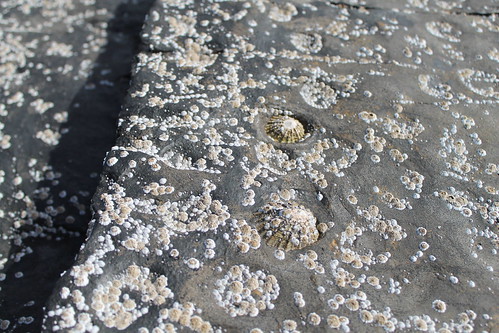 |
| Limpets stuck to the bedrock at Hoy Harbor during low tide. As water washes over them, it erodes little pockets around each limpet creating a pitted pattern on the rock. |
Maeshowe is a fantastic Neolithic site, nearly 5,000 years old. You have to book a tour in advance, and in the summer there are extra "twilight" tours in the evenings, which aren't really twilight since the sun pretty much never sets. To get into Maeshowe, you have to stoop quite low and walk through a ten-meter passageway lined in massive, single blocks of stone. Once inside, you're able to stand up in a square chamber with what was once a corbelled ceiling (but is now a poorly constructed brick dome structure put in place in the early 1900s). Maeshowe is similar to other chambered tombs of the area in that opposite the door and on either side wall are two recessed and L-shaped chambers. In other tombs of this age, human bones have been found stored in these chambers, grouped by bone-type, rather than full skeletons. It is thought that Maeshowe served a similar purpose but very few bones have actually been found there. It may have also served a more ceremonial purpose, archaeologists think, suggested by the fact that the entrance to the tomb directly faces the setting sun on the Winter Solstice. Curiously, on the solstice, the sun sets behind the massive mountains of Hoy, and it is thought that they also served some spiritual purpose. Furthermore, the ceremonial significance of Maeshowe is suggested by its proximity to the Standing Stones of Stenness, the Ring and Ness of Brodgar, and the Barnhouse Village.
In the 12th century, multiple groups of Vikings were vying for control of Orkney and one group started off one morning in Stromness but got caught in a storm and took shelter in Maeshowe, leaving cryptic messages of the runic alphabet carved into some of the stones. They spoke of the treasures of the North and one claimed to be a master writer of runes who and carved his message using a very famous axe, used to slay Gauk - don't ask me the history of that; all I know is that the axe was well-known.
My favorite bit about Maeshowe, though, again were the slabs of rock. The entrance tunnel was lined and covered with ten-meter long single slabs of sandstone, and the lintel above each of the recesses off the main chamber, which were five meters by at least three meters, were each carved of a single slab of rock. How those people 5,000 years ago were able to move such large pieces of rock over large distances still baffles me as well as archaeologists, and as to how it was done is still anyone's guess.
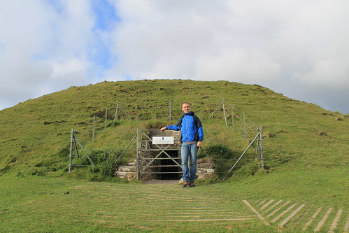 |
| In front of the entrance to Maeshowe. No photos are allowed inside, but it's pretty amazing |
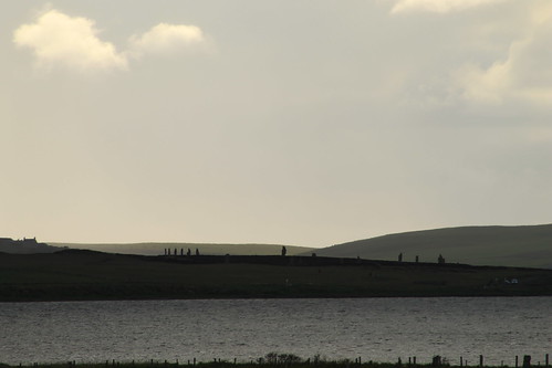 |
| One last look over to the Ring of Brodgar |
Upon leaving the tomb, I gave one last look around the landscape, taking a few more photos, before heading back to the visitors center to wait for the last bus into Kirkwall. I bought a few postcards and got some good music suggestions from the woman working the shop, and indulged myself into a wee tub of ice cream from the Orkney Creamery, which was delicious (I suggest the Toffee Swirl and the Orkney Original).
Back in Kirkwall, I ran into some girls who were out at the Old Man of Hoy when I was there that day, and we chatted a while over some coffees and snacks in a little craft shop/coffee house, Judith Glue. The girls were fun to chat with, but they had already eaten dinner and I needed some substantial food before 9pm, so I said goodbye to them and headed out to see my final fish and chips of the trip. I caught the shop just before they closed and took my food out to the harbor to eat. It wasn't quite 10pm yet and I realized that I did want to purchase something to remember Orkney by, and I went back to Judith Glue (which stays open until 10pm!) and purchased a few prints done by a local artist and a bottle of Dark Island, brewed by the Orkney Brewery - as suggested by a man at the pub where I got dinner the night before - and headed back to my hostel where I watched the Queen's Diamond Jubilee concert at Buckingham Palace and wrote my postcards. That night, as part of the Jubilee, beacons, or torches or bonfires, were being lit around the UK and the world in commonwealth countries. Stromness had their own beacon and I was tipped that Kirkwall would be having their own as well on top of a radio-antennae hill visible from the hostel's kitchen window. I kept getting up to see if I could see the fire, but it was either too small or they didn't have one, so I stayed in, repacking my bags, and finally dozing off to sleep.
My legs were sore, feet were covered in blisters, and my brain hurt from trying to piece together all the Orcadian history I had taken in over the past few days. But I fell asleep the moment my head hit the pillow and I would soon be saying goodbye to this beautiful but chilly island paradise of northern Scotland.

No comments:
Post a Comment